भारतीय प्रौद्योगिकी संस्थान इंदौर Indian Institute of Technology Indore
IIT Indore
भारतीय प्रौद्योगिकी संस्थान इंदौर Indian Institute of Technology Indore
IIT Indore
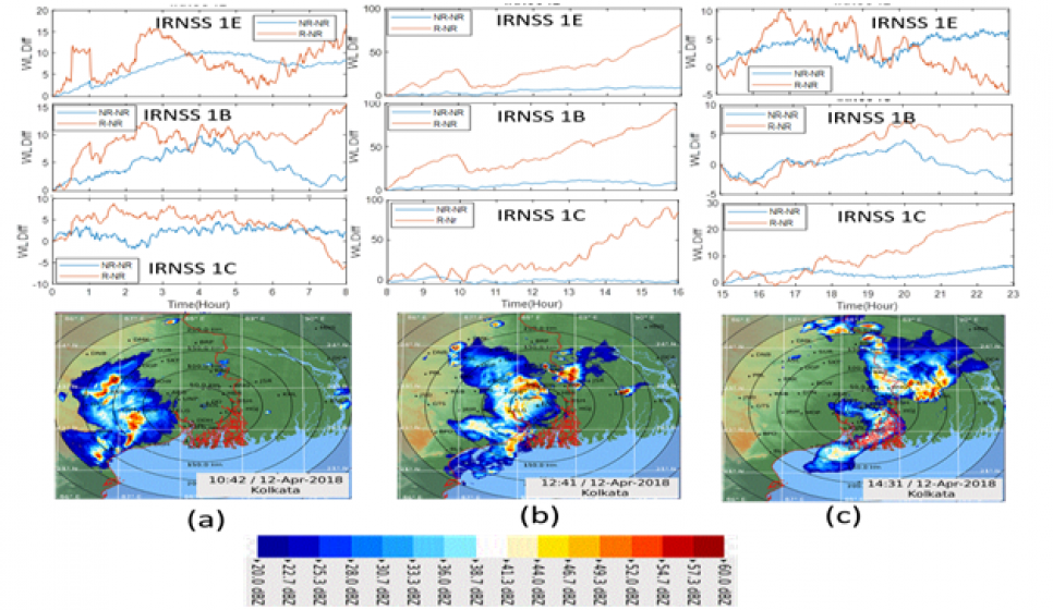
The research focus is on developing new techniques for remote sensing of atmospheric constituents using Global Navigation Satellite Systems (GNSS). The Indian Regional Navigation Satellite System, NavIC is the latest satellite constellation and our group working on to utilize the S-band signal for developing the early warning system of thunderstorm.
Fig. 1: A Dynamic Time Warping Algorithm to detect thunderstorm using NavIC satellite signals. Warping line variation of three sessions of the day and movement of the cloud system as observed by Doppler radar cloud imagery.
Ø Climate and Space Weather:
The research focus of this group is to understand climate and space weather events using ground-based and space -based sensors. Machine learning and data science techniques are deployed to investigate and model different physical phenomena.
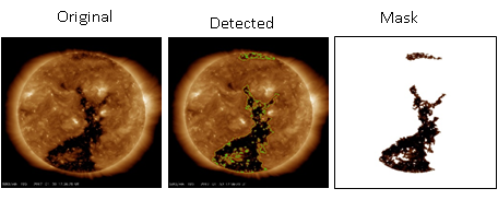 |
Fig. 2: Solar Coronal Hole Detection in SDO/AIA Images using Fazzy Active Contour Image Segmentation Technique
